Contrafuerte
  • Inicio
  • Colaboradores
    • Colaboradores
    • Política de privacidad
  • Categorías
    • Agua y medio ambiente
    • Construcción
    • Desarrollo Urbano
    • Editorial
    • Gremial
    • Normatividad
    • Patrimonio
    • Videoconferencias y Videos
    • Todas
  • Canal de YouTube
Select Page
GIS-multicriteria evaluation using AHP for Geohazards susceptibility mapping in the city of La Paz, Baja California Sur, Mexico (Vista Hermosa urban settlement)

GIS-multicriteria evaluation using AHP for Geohazards susceptibility mapping in the city of La Paz, Baja California Sur, Mexico (Vista Hermosa urban settlement)

by Joel Hirales Rochin | May 20, 2022 | Desarrollo Urbano

Abstract- Actually, geology has become a fundamental tool to determine areas of susceptibility, vulnerability and geological risk. The geological dynamics and the accelerated changes of the processes at the climatic level in the last decades have demonstrated the...
Análisis de parámetros geomecánicos RQD-RMR-GSI de la litología expuesta en la porción NE-SE de la ciudad de La Paz, B.C.S., México.

Análisis de parámetros geomecánicos RQD-RMR-GSI de la litología expuesta en la porción NE-SE de la ciudad de La Paz, B.C.S., México.

by Joel Hirales Rochin | May 17, 2022 | Desarrollo Urbano

Desde la antigüedad, las rocas naturales han sido utilizadas para mejorar la calidad de vida de las poblaciones, como materiales base para la construcción de obras de infraestructura en elementos estructurales (columnas, muros y cimientos), materiales de...
Geospatial Mapping of Flood Susceptibility via Multi-Criteria Analysis AHP and GIS: La Paz Basin, Baja California Sur., Mexico.

Geospatial Mapping of Flood Susceptibility via Multi-Criteria Analysis AHP and GIS: La Paz Basin, Baja California Sur., Mexico.

by Joel Hirales Rochin | Sep 3, 2021 | Desarrollo Urbano

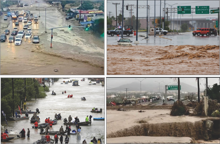
Abstract- The research presents the multi-criteria analysis approach (MCA) to describe the effective use of geospatial techniques for the reduction of geohydrological risk and its relationship with urban territorial development at the local level, in the case of the...
Application of the Analytical Hierarchy Process (AHP) for Geo-Hazards Susceptibility Mapping: Urban Settlement Marquez De León, La Paz., Mexico.

Application of the Analytical Hierarchy Process (AHP) for Geo-Hazards Susceptibility Mapping: Urban Settlement Marquez De León, La Paz., Mexico.

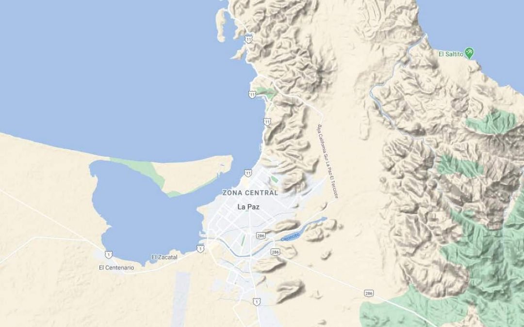
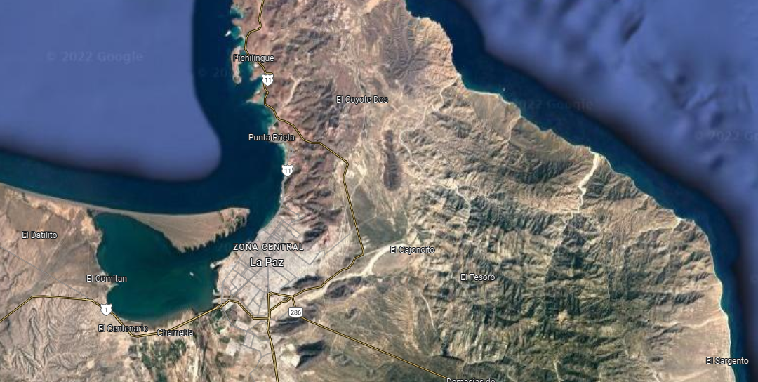
by Joel Hirales Rochin | Nov 23, 2020 | Agua y medio ambiente, Desarrollo Urbano

Abstract- Geology as a tool to identify areas of geological risk is useful to determine the close relationship between the geological space and the sustainable urban development of a city. At the national, regional and local level where the study area is located,...
Risk susceptibility mapping based on the urban geology of the city of La Paz, B.C.S., Mexico (NE-SE portion)

Risk susceptibility mapping based on the urban geology of the city of La Paz, B.C.S., Mexico (NE-SE portion)

by Joel Hirales Rochin | Jul 19, 2020 | Desarrollo Urbano

Joel Hirales Rochin1 1Geologist Head of Research Projects and professor of the Area of Earth Sciences, Department of Civil Engineering, Technological Institute of La Paz, Boulevard Forjadores of Sudcalifornia. La Paz, Baja California Sur., Mexico....

Categorías

  • Agua y medio ambiente
  • Construcción
  • Desarrollo Urbano
  • Editorial
  • Gremial
  • Normatividad
  • Patrimonio
  • Videoconferencias y Videos

Enlaces

  • Inicio
  • Colaboradores
  • Canal de YouTube
  • Política de privacidad

Compartir

http://contrafuerte.com.mx © 2020